
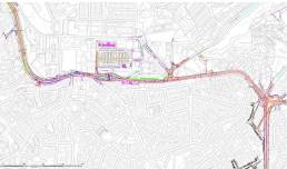
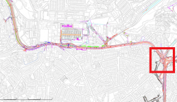
Paceville - St Andrew’s
Another car-centric project in the making and new barriers to active mobilityPA/06089/19
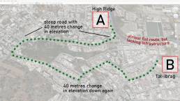
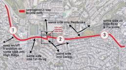
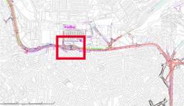
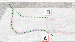
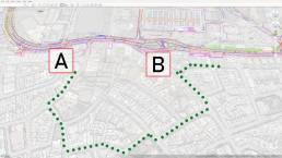
St Andrew’s Road is a very important corridor linking the highly densely urbanised areas of Swieqi, Tal-Ibraġ, Pembroke and Paceville at short walking & cycling distances from each other.
There has never been any thought to cycling and walking provisions however.
Emphasis should be made at providing safe connections from A to B cohesively at all points. Since bicycles are non-motorised, efficiency is key to reduce unnecessary stops and gradients found in the area.
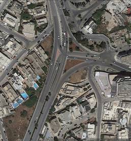
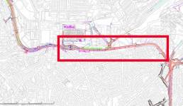
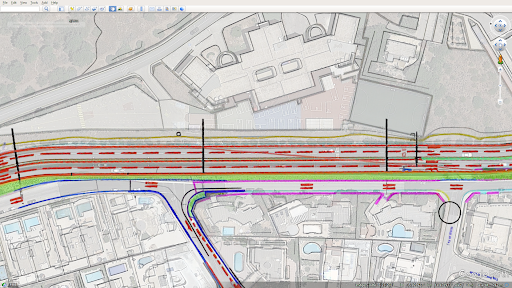
Meanwhile, what Infrastructure Malta are proposing as of June 2023
Plans retrieved from MaltaToday, article published on 8 June 2023. We at Rota truly wish to be included in consultations from the early design stages alongside councils and other stakeholders, to make sure together that the project is planned holistically with space being fairly distributed towards all road users without afterthought.
A detailed step-by-step analysis is provided further down throughout this webpage, together with our deep concerns regarding public safety.
The 5 design principles for bicycle infrastructure: cohesion, directness, safety, comfort and attractiveness could not be found throughout the project. This current draft unfortunately shows a reality heading to a completely opposite direction. Malta needs alternative infrastructure in today’s day and age more than ever before.
Step-by-step analysis: part A
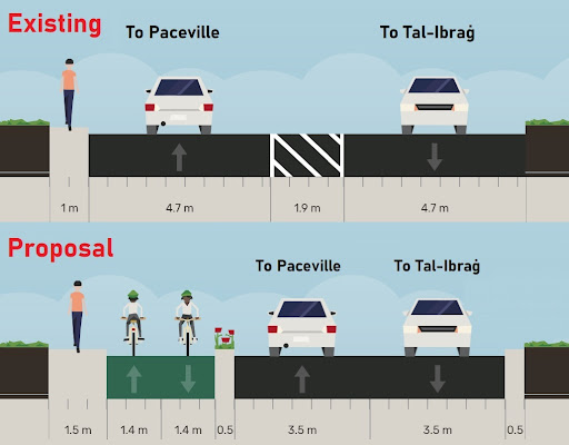
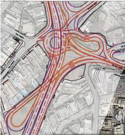
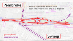
Paceville junction
Paceville junction: existing & proposed side-by-side by Infrastructure Malta
Deciphering some of the unsafe cycling connections
i) Swieqi to Paceville and back
ii) Swieqi to Baystreet and back
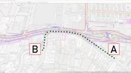
Step-by-step analysis: part B
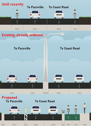
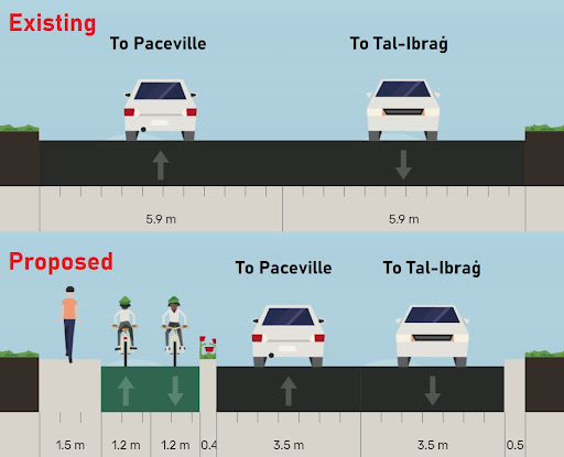
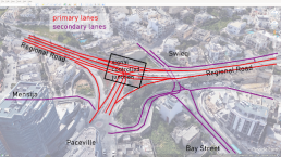
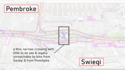
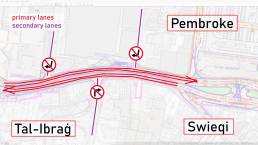
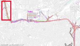
The main road
The main road: existing & proposed side-by-side by Infrastructure Malta
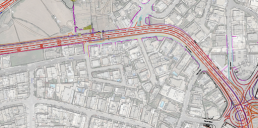
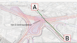
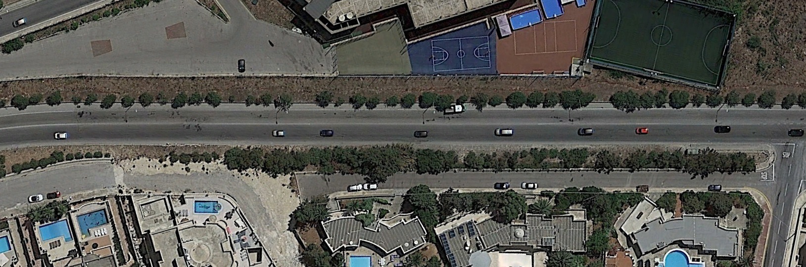
Infrastructure Malta is proposing to widen the main road to 4 lanes with no bicycle path.
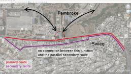
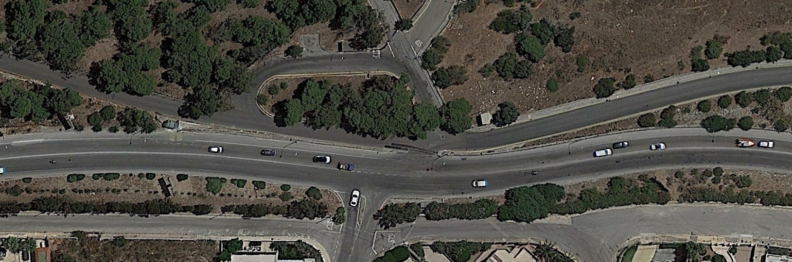
This section of the main road has a parallel “service road”, which is quieter; serves and connects well into several Swieqi neighbourhoods.
However parts are hillier (east side); involves more turns and stops; requires several contraflow exemptions to one-way streets to make it legally work – and most importantly it does not connect with the junction to Pembroke.
A bike path is required on the main road just as well, for directness along the route, and connections to Pembroke.
This space is acquired by reinforcing a 2-lane design of the road.
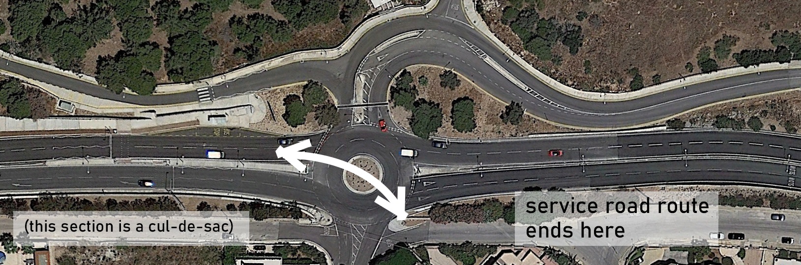
In either case, the parallel route stops short & rejoins the main road to the left of the map above, by the Park & Ride
Step-by-step analysis: part C
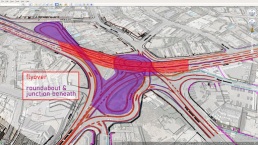
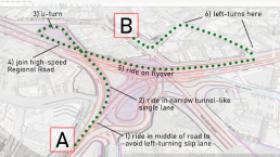
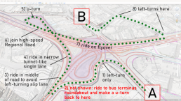
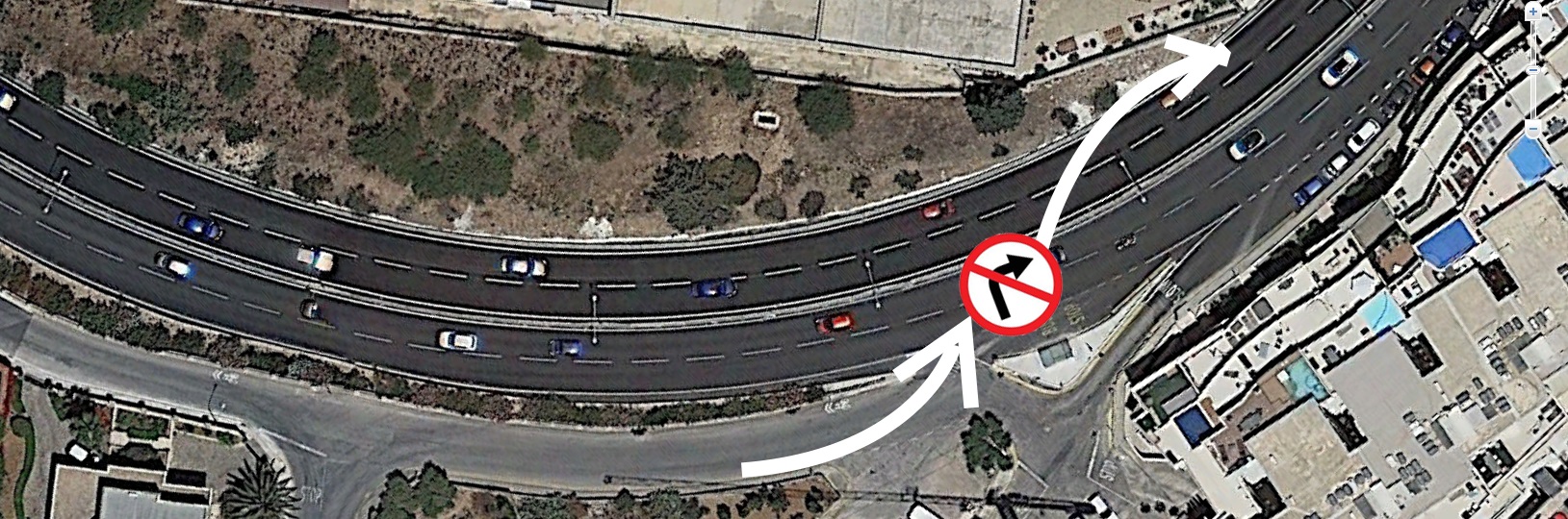
The Park & Ride junction
How does a bicycle user traverse the Park & Ride junction in either direction: across Swieqi to Pembroke & Pembroke to Swieqi?
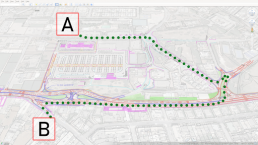
Bicycle users to ride longer ways & unprotected on the same high-speed roads with cars.
Step-by-step analysis: part D
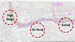
The Tal-Ibraġ junction
Similarly, more missing connections: more no right-turns Forcing cyclists to ride longer ways (& unprotected) on the same car routes. More unsafe detours as shown in part C?
At the end of parallel route shown in part B, how well protected is a cyclist now to rejoin this main road and continue these last 100m to enter Tal-Ibraġ? This direction might by physically accessible, but unsafe.
But viceversa? Should they take the long unsafe main road?
Or this unintuitive maze through town? Will drivers discover this and turn it into a busy vehicular shortcut?
Step-by-step analysis: part E
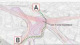
The High Ridge area & its service road
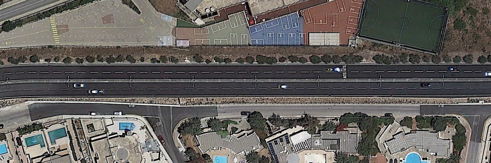
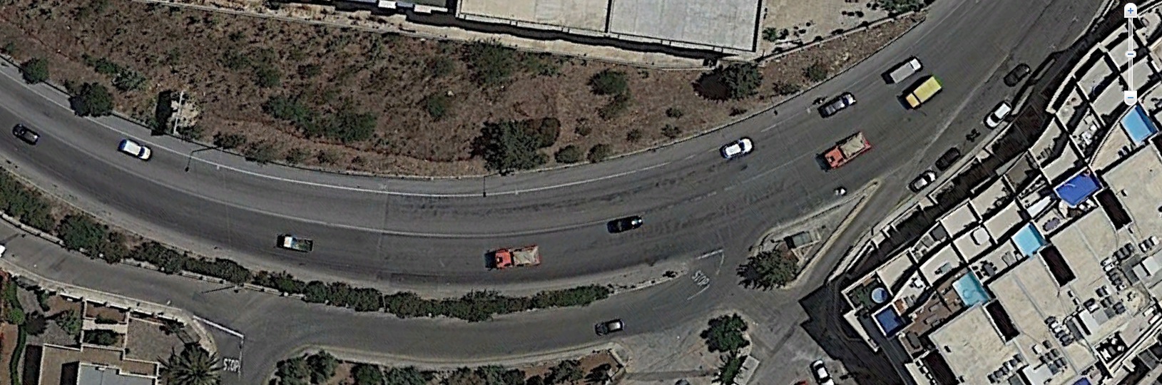
Until recently, this section was a 2-lane road with bicycle lanes on either side. The project’s proposal has now already been built throughout this section. It has been recently widened to 4 lanes and bicycle lanes removed.
Cyclists are now pushed into the parallel service road, which has steeper elevations and goes from nowhere to nowhere.
At the northern end of the parallel service road, a cyclist is quickly forced to rejoin the main road. The junction has been replaced with a 2-lane roundabout, with no facilities for a cyclist to turn safely around. This is coupled with the fact that the road’s capacity has been doubled up from 2 to 4 lanes, meaning watching out for double the number of cars incoming at any moment.
If a bicycle user goes through the safety hassle of crossing the roundabout into this service road to travel back south the journey is cut short as they cannot proceed further south at the end, it will be against traffic. Nor can they cannot cross back onto the other side again.
High Ridge has turned completely detached from the rest of Swieqi.
Combining parts C, D & E of this analysis
In the span of just 300 metres, High Ridge, Tal-Ibraġ and the rest of Swieqi are:
- completely inaccessible by bicycle towards the south/east
- (and physically accessible but dangerously so, towards the north/west)
Tal-Ibraġ and Swieqi might technically be considered to be partially accessible, albeit wrongly, as shown earlier and again now:
However High Ridge and Tal-Ibraġ are not…
… hoping that this is not suggested to be a viable cycling route: